map of iran highlighted. arrow showing ussr russia place for possible infiltration invasion. more arrows through turkey the mediterranean iraq arabia... - us school map stock videos & royalty-free footage00:27Possibly opening a 'Red' roadIran, USA, Education
first fifty: ebe's golden anniversary retrospective - part 13 of 29. in this 50th anniversary retrospective film, we hear thomas edison's words proclaim that educational films would one day replace the textbook as the basic tool of education. in the 1958 - us school map stock videos & royalty-free footage00:34First Fifty: EBE's Golden Anniversary Retrospective - part 13 of 29. In this 50th anniversary retrospective film, we hear Thomas Edison's words proclaim that educational films would one day replace the textbook as the basic tool of education. In the 1958Education, Anniversary, Archival
body being covered with dirt / child being fed / starving women / woman on her knees praying / war wreckage, destroyed buildings, lone smokestack... - us school map stock videos & royalty-free footage02:02World War II: casualties and victims in the aftermath of warWorld War II, Archival, Newsreel
close up on antique us map: west coast - us school map stock videos & royalty-free footage00:10Close up on antique US map: West CoastMap, California, Retro Style
map of the usa - us school map stock videos & royalty-free footage00:16Map of the USAUSA, Map, Digitally Generated Image
3d representation of the united states with colorful state boundaries and elevations showcased in a visual display. 3d animation - us school map stock videos & royalty-free footage00:083D representation of the United States with colorful state boundaries and elevations showcased in a visual display. 3D animationUSA, Map, American Culture
us regions: contrasts of land and people - part 2 of 53. using both animation and live-action photography, this film enables viewers to tour a richly diverse country that can be divided into eight regions: new england, the middle atlantic, the south, the - us school map stock videos & royalty-free footage00:30US Regions: Contrasts of Land and People - part 2 of 53. Using both animation and live-action photography, this film enables viewers to tour a richly diverse country that can be divided into eight regions: New England, the Middle Atlantic, the South, theUSA, Map, Colours
us in the colors of the american flag - us school map stock videos & royalty-free footage00:30US in the colors of the American flagUSA, Map, Election
close up on antique us map: illinois, indiana and ohio - us school map stock videos & royalty-free footage00:16Close up on antique US map: Illinois, Indiana and OhioMap, American Culture, District
what makes weather? (2nd edition) - part 22 of 24. vivid satellite footage, helpful animation, and live action and time-lapse photography show the working forces that produce weather. the film examines the movement of winds and air masses caused by the un - us school map stock videos & royalty-free footage00:35What Makes Weather? (2nd edition) - part 22 of 24. Vivid satellite footage, helpful animation, and live action and time-lapse photography show the working forces that produce weather. The film examines the movement of winds and air masses caused by the un1980-1989, Office, Weather
us regions: contrasts of land and people - part 4 of 53. using both animation and live-action photography, this film enables viewers to tour a richly diverse country that can be divided into eight regions: new england, the middle atlantic, the south, the - us school map stock videos & royalty-free footage00:31US Regions: Contrasts of Land and People - part 4 of 53. Using both animation and live-action photography, this film enables viewers to tour a richly diverse country that can be divided into eight regions: New England, the Middle Atlantic, the South, theUSA, Map, Empire
southwestern states (2nd edition) - part 1 of 19. traces population trends and explains geographical features by means of animated maps. illustrates such occupational activities as irrigation, stock raising, agriculture, mining, and oil extracting and ref - us school map stock videos & royalty-free footage00:29Southwestern States (2nd edition) - part 1 of 19. Traces population trends and explains geographical features by means of animated maps. Illustrates such occupational activities as irrigation, stock raising, agriculture, mining, and oil extracting and refMap, USA, New Mexico
us regions: contrasts of land and people - part 16 of 53. using both animation and live-action photography, this film enables viewers to tour a richly diverse country that can be divided into eight regions: new england, the middle atlantic, the south, the - us school map stock videos & royalty-free footage00:25US Regions: Contrasts of Land and People - part 16 of 53. Using both animation and live-action photography, this film enables viewers to tour a richly diverse country that can be divided into eight regions: New England, the Middle Atlantic, the South, theMiami, 1980-1989, Map
1939 montage teacher inside classroom / lowndes county, alabama, united states - us school map stock videos & royalty-free footage00:081939 MONTAGE teacher inside classroom / Lowndes County, Alabama, United StatesClassroom, Education, Black And White
4k resolution israel - gaza - west bank map - us school map stock videos & royalty-free footage00:204K Resolution Israel - Gaza - West Bank MapMap, Israel, Jerusalem
far western states (2nd edition) - part 18 of 19. surveys the region's geography, history, agriculture, and natural resources and describes the far west's enormous growth and commercial expansion in recent decades - us school map stock videos & royalty-free footage00:32Far Western States (2nd edition) - part 18 of 19. Surveys the region's geography, history, agriculture, and natural resources and describes the Far West's enormous growth and commercial expansion in recent decadesArchival, 1950-1959, Old-fashioned
close up on antique us map: east coast - us school map stock videos & royalty-free footage00:09Close up on antique US map: East CoastMap, Coastline, Panning
the gasoline age (history of transportation, part ii) - part 4 of 23. this film describes the rapid changes that have taken place in the transportation of the united states since the coming of the automobile. describes the growth and decline of railroads, - us school map stock videos & royalty-free footage00:40The Gasoline Age (History of Transportation, Part II) - part 4 of 23. This film describes the rapid changes that have taken place in the transportation of the United States since the coming of the automobile. Describes the growth and decline of railroads,Major Road, 1950-1959, USA
us regions: contrasts of land and people - part 3 of 53. using both animation and live-action photography, this film enables viewers to tour a richly diverse country that can be divided into eight regions: new england, the middle atlantic, the south, the - us school map stock videos & royalty-free footage00:30US Regions: Contrasts of Land and People - part 3 of 53. Using both animation and live-action photography, this film enables viewers to tour a richly diverse country that can be divided into eight regions: New England, the Middle Atlantic, the South, theMap, USA
high school girl chews gum as fellow student listens to teacher - us school map stock videos & royalty-free footage00:07High school girl chews gum as fellow student listens to teacherBubble Gum, Teenager, Adolescence
4k resolution israel - gaza - west bank map - us school map stock videos & royalty-free footage00:154K Resolution Israel - Gaza - West Bank MapIsrael, Map, Gaza Strip
close up on antique us map: washington and idaho - us school map stock videos & royalty-free footage00:20Close up on antique US map: Washington and IdahoMap, Paper, Old
far western states (2nd edition) - part 7 of 19. surveys the region's geography, history, agriculture, and natural resources and describes the far west's enormous growth and commercial expansion in recent decades - us school map stock videos & royalty-free footage00:34Far Western States (2nd edition) - part 7 of 19. Surveys the region's geography, history, agriculture, and natural resources and describes the Far West's enormous growth and commercial expansion in recent decadesMap, USA, California
close up on antique us map: new hampshire counties - us school map stock videos & royalty-free footage00:13Close up on antique US map: New Hampshire countiesMap, New Hampshire, Old-fashioned
map of u.s.a. highlighting plants, laboratories, colleges, universities, industrial firms. hanford,' washington; 'los alamos,' new mexico; 'oak... - us school map stock videos & royalty-free footage00:35Atomic Energy Plant MapLaboratory
us regions: contrasts of land and people - part 42 of 53. using both animation and live-action photography, this film enables viewers to tour a richly diverse country that can be divided into eight regions: new england, the middle atlantic, the south, the - us school map stock videos & royalty-free footage00:29US Regions: Contrasts of Land and People - part 42 of 53. Using both animation and live-action photography, this film enables viewers to tour a richly diverse country that can be divided into eight regions: New England, the Middle Atlantic, the South, theMap, 1980-1989, USA
seismic recorder loop 04 - us school map stock videos & royalty-free footage00:05seismic recorder loop 04Earthquake, Seismograph, Lie Detector
buckingham school. int classroom w/ boy at map, problem pronouncing a city in poland , young girl of polish decent helping him. int clasroom w/ girl... - us school map stock videos & royalty-free footage00:571944: SCHOOL: EXT Buckingham School. INT Classroom w/ boy at map, problem pronouncing a city in Poland (Lwow), young girl of Polish decent helping him. INT Clasroom w/ girl at map of Brazil, talking about races there, children & teacher listening.Poland, Education, Black And White
exterior of new york city police station / line of volunteers in police station / close up of volunteers in line / officers filling out paperwork... - us school map stock videos & royalty-free footage02:12Civil Defense Program Begins In New York CityPaperwork, Map, Classroom
ancient aztec indians of north america - part 1 of 13. describes the aztec invasion of mexico - when warlike barbarians sought to create the last great indian civilization. the tribes they conquered were forced to produce goods and offer sacrificial victi - us school map stock videos & royalty-free footage00:29Ancient Aztec Indians of North America - part 1 of 13. Describes the Aztec invasion of Mexico - when warlike barbarians sought to create the last great Indian civilization. The tribes they conquered were forced to produce goods and offer sacrificial victiAztec Civilization, Map, USA
vintage globe showing north- and central america, asia, africa, and europe - us school map stock videos & royalty-free footage00:19Vintage Globe Showing North- and Central America, Asia, Africa, And EuropeOld, Europe, Globe - Navigational Equipment
republican white house project 2025 - us school map stock videos & royalty-free footage00:05Republican White House Project 2025USA, Tariff, Military
southwestern states (2nd edition) - part 17 of 19. traces population trends and explains geographical features by means of animated maps. illustrates such occupational activities as irrigation, stock raising, agriculture, mining, and oil extracting and re - us school map stock videos & royalty-free footage00:32Southwestern States (2nd edition) - part 17 of 19. Traces population trends and explains geographical features by means of animated maps. Illustrates such occupational activities as irrigation, stock raising, agriculture, mining, and oil extracting and reCar, Map, Arizona
southwestern states (2nd edition) - part 2 of 19. traces population trends and explains geographical features by means of animated maps. illustrates such occupational activities as irrigation, stock raising, agriculture, mining, and oil extracting and ref - us school map stock videos & royalty-free footage00:30Southwestern States (2nd edition) - part 2 of 19. Traces population trends and explains geographical features by means of animated maps. Illustrates such occupational activities as irrigation, stock raising, agriculture, mining, and oil extracting and refMap, Archival, Old-fashioned
the netherlands pops up after earth zoom (with alpha matte) - us school map stock videos & royalty-free footage00:22the Netherlands pops up after earth zoom (with alpha matte)Netherlands, Globe - Navigational Equipment, The Hague
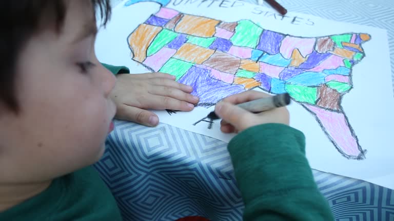
a four year old boy drawing and creating a map outside at a picnic table. - us school map stock videos & royalty-free footage00:18A four year old boy drawing and creating a map outside at a picnic table.Map, Child, Learning
ireland pops up after earth zoom (with alpha matte) - us school map stock videos & royalty-free footage00:22Ireland pops up after earth zoom (with alpha matte)USA, Scotland, Globe - Navigational Equipment
outtakes from various educational film productions - us school map stock videos & royalty-free footage00:301950s:Model of globe spins. Light shines on model of globeSpinning, Planet - Space, Turning
the gasoline age (history of transportation, part ii) - part 19 of 23. this film describes the rapid changes that have taken place in the transportation of the united states since the coming of the automobile. describes the growth and decline of railroads - us school map stock videos & royalty-free footage00:29The Gasoline Age (History of Transportation, Part II) - part 19 of 23. This film describes the rapid changes that have taken place in the transportation of the United States since the coming of the automobile. Describes the growth and decline of railroadsUSA, Map
the gasoline age (history of transportation, part ii) - part 15 of 23. this film describes the rapid changes that have taken place in the transportation of the united states since the coming of the automobile. describes the growth and decline of railroads - us school map stock videos & royalty-free footage00:29The Gasoline Age (History of Transportation, Part II) - part 15 of 23. This film describes the rapid changes that have taken place in the transportation of the United States since the coming of the automobile. Describes the growth and decline of railroadsUSA, Map
ha ws man on playground blacktop painting outline of us states map/ children filling in states with different colors/ children standing on map and jumping up and down/ michigan - us school map stock videos & royalty-free footage00:24HA WS man on playground blacktop painting outline of US states map/ children filling in states with different colors/ children standing on map and jumping up and down/ Michigan
diverse private stem middle school students work on project together - us school map stock videos & royalty-free footage00:10Diverse private STEM middle school students work on project togetherDiscussion, Education, Classroom
4k resolution israel - gaza - west bank - jerusalem map - us school map stock videos & royalty-free footage00:154K Resolution Israel - Gaza - West Bank - Jerusalem MapMap, Gaza Strip
the galapagos: darwin's world within itself - part 2 of 32. discloses the diverse and unique biology of the volcanically formed galapagos islands which were discovered by charles darwin and provided the basis for his theory of evolution. the film recounts - us school map stock videos & royalty-free footage00:24The Galapagos: Darwin's World Within Itself - part 2 of 32. Discloses the diverse and unique biology of the volcanically formed Galapagos Islands which were discovered by Charles Darwin and provided the basis for his theory of evolution. The film recountsMap, Galapagos Islands, Central America
republican project 2025 - us school map stock videos & royalty-free footage00:07Republican Project 2025USA, National Guard, Undocumented Immigrant
a young boy looking at a map outdoors on a sunny day. - us school map stock videos & royalty-free footage00:21A young boy looking at a map outdoors on a sunny day.Child, Childhood, Map
us regions: contrasts of land and people - part 37 of 53. using both animation and live-action photography, this film enables viewers to tour a richly diverse country that can be divided into eight regions: new england, the middle atlantic, the south, the - us school map stock videos & royalty-free footage00:37US Regions: Contrasts of Land and People - part 37 of 53. Using both animation and live-action photography, this film enables viewers to tour a richly diverse country that can be divided into eight regions: New England, the Middle Atlantic, the South, theCalifornia, Old-fashioned, USA
ancient aztec indians of north america - part 2 of 13. describes the aztec invasion of mexico - when warlike barbarians sought to create the last great indian civilization. the tribes they conquered were forced to produce goods and offer sacrificial victi - us school map stock videos & royalty-free footage00:30Ancient Aztec Indians of North America - part 2 of 13. Describes the Aztec invasion of Mexico - when warlike barbarians sought to create the last great Indian civilization. The tribes they conquered were forced to produce goods and offer sacrificial victiAztec Civilization, Old-fashioned, Central America
north africa & the middle east. from morocco algeria tunisia libya egypt to map of middle eastern countries. - us school map stock videos & royalty-free footage00:33N. Africa Middle East mapMap, Middle East
minimal blue political map of europe and asia - us school map stock videos & royalty-free footage00:15Minimal Blue Political Map of Europe and AsiaWorld Map, Global
animation of a seismic tremors recorder - us school map stock videos & royalty-free footage00:05animation of a seismic tremors recorderEarthquake, Seismograph, Geology
ha ws children on playground filling in states with different colors on outline map of us/ michigan - us school map stock videos & royalty-free footage00:14HA WS children on playground filling in states with different colors on outline map of US/ MichiganGirls, Summer, Michigan
3d us map and star with flag pattern and vote logo - us school map stock videos & royalty-free footage00:303D US map and star with flag pattern and vote logoUSA, Politics, Separation
children sitting at desks reading silently from open text books, female teacher standing in back of classroom, mounted map of united states pulled... - us school map stock videos & royalty-free footage00:281953: LEVITTOWN, PENNSYLVANIA: GRADE SCHOOL: WS Children (fourth, fifth grade) sitting at desks reading silently from open text books, female teacher standing in back of classroom, mounted map of United States pulled down covering blackboard.Classroom, Black And White, Map
congress and republican agenda - us school map stock videos & royalty-free footage00:08Congress and Republican AgendaTariff, US Republican Party, USA
iran pops up after earth zoom (with alpha matte) - us school map stock videos & royalty-free footage00:22Iran pops up after earth zoom (with alpha matte)Map, Middle East, Globe - Navigational Equipment
3d us map and star with flag pattern - us school map stock videos & royalty-free footage00:303D US map and star with flag patternPolitics, USA, Separation
egypt pops up after earth zoom (with alpha matte) - us school map stock videos & royalty-free footage00:22Egypt pops up after earth zoom (with alpha matte)Suez Canal, Map, Memphis - Egypt
us in the colors of the american flag - us school map stock videos & royalty-free footage00:30US in the colors of the American flagElection, USA, 2024
buckingham school. int classroom w/ boy at map, problem pronouncing a city in poland , young girl of polish decent helping him. int classroom w/ girl... - us school map stock videos & royalty-free footage00:571944: SCHOOL: EXT Buckingham School. INT Classroom w/ boy at map, problem pronouncing a city in Poland (Lwow), young girl of Polish decent helping him. INT Classroom w/ girl at map of Brazil, talking about races there, children & teacher listening.Map, Teacher, Classroom
china pops up after earth zoom (with alpha matte) - us school map stock videos & royalty-free footage00:22China pops up after earth zoom (with alpha matte)Globe - Navigational Equipment, Map
us in the colors of the american flag - us school map stock videos & royalty-free footage00:30US in the colors of the American flagElection, USA, 2024
montage b/w ms teacher pointing to map in classroom / ms zi cu girl daydreaming at her desk / oakdale, california, usa - us school map stock videos & royalty-free footage00:27MONTAGE B/W MS Teacher pointing to map in classroom / MS ZI CU Girl daydreaming at her desk / Oakdale, California, USAMap, Classroom, Women
finland pops up after earth zoom (with alpha matte) - us school map stock videos & royalty-free footage00:22Finland pops up after earth zoom (with alpha matte)Europe, Map, Norway
pan up to portrait of teacher writing at her desk / looking up and smiling at camera / gorham, maine - us school map stock videos & royalty-free footage00:11Pan up to portrait of teacher writing at her desk / looking up and smiling at camera / Gorham, MaineMap
plane spotter william rozak uses binoculars to look to the sky / high-school students rozak and ronald newman on roof of factory building with their... - us school map stock videos & royalty-free footage01:01Teenaged boys participate in Ground Observer Corps of US Civil Defense & Disaster Control during World War IIMap
female teacher standing, sixth graders at tables writing, airplane posters bg. boys mapping air routes on map . dramatization: vs boy in class... - us school map stock videos & royalty-free footage00:211936: U.S. ELEMENTARY SCHOOL: CLASS: INT MS Female teacher standing, sixth graders at tables writing, airplane posters BG. MS Boys mapping air routes on map (Geography). DRAMATIZATION: VS Boy in class reading self written story (SOT). MS Boy listeningClassroom, Learning, Boys
belgium pops up after earth zoom (with alpha matte) - us school map stock videos & royalty-free footage00:22Belgium pops up after earth zoom (with alpha matte)Belgium, Globe - Navigational Equipment, Map
earth zooming in on… burma (with alpha matte) - us school map stock videos & royalty-free footage00:22Earth zooming in on… Burma (with alpha matte)Map, Bangladesh, Myanmar
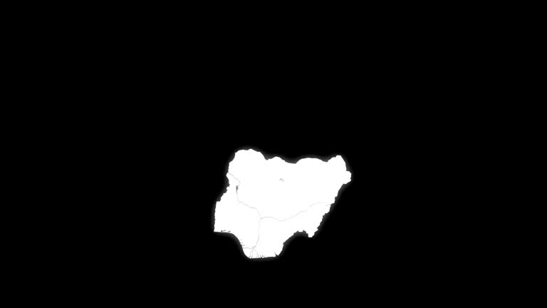
nigeria pops up after earth zoom (with alpha matte) - us school map stock videos & royalty-free footage00:22Nigeria pops up after earth zoom (with alpha matte)Nigeria, Map, Globe - Navigational Equipment
ukraine pops up after earth zoom (with alpha matte) - us school map stock videos & royalty-free footage00:22Ukraine pops up after earth zoom (with alpha matte)Crimea, Map
ethiopia pops up after earth zoom (with alpha matte) - us school map stock videos & royalty-free footage00:22Ethiopia pops up after earth zoom (with alpha matte)Ethiopia, Map, Tigray
tanzania pops up after earth zoom (with alpha matte) - us school map stock videos & royalty-free footage00:22Tanzania pops up after earth zoom (with alpha matte)Map
animation of a seismic tremors recorder - us school map stock videos & royalty-free footage00:05animation of a seismic tremors recorderSeismic Wave, Seismograph, Animated Video
narrator/teacher speaks to camera, looking at card listing the steps to self reliance. - us school map stock videos & royalty-free footage00:21Developing Self Reliance, part 15 of 21One Person, Confidence, Classroom
numerous arrests were made by responding police officers at nyu's gould plaza on monday, april 22, the nypd's deputy commissioner kaz daughtry... - us school map stock videos & royalty-free footage05:08'Numerous Arrests' as Police Move to Clear NYU ProtestersNew York University, Arrest
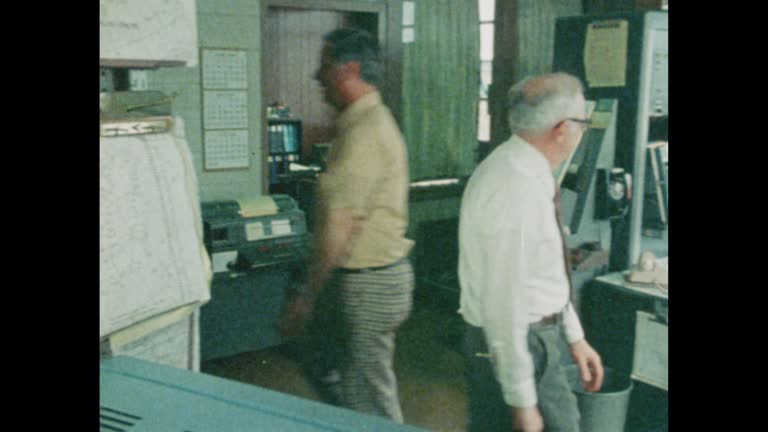
man gestures to a map as he offers instruction to fellow professionals at bell laboratories in 1964. - us school map stock videos & royalty-free footage00:20Professional Instruction 1964Laboratory, Bell, Learning
problems of conservation: wildlife - part 8 of 24. as man changes the earth to suit his needs, survival becomes more difficult for wildlife. film identifies endangered species; examines current efforts to conserve wildlife; emphasizes the importance of ev - us school map stock videos & royalty-free footage00:30Problems of Conservation: Wildlife - part 8 of 24. As man changes the earth to suit his needs, survival becomes more difficult for wildlife. Film identifies endangered species; examines current efforts to conserve wildlife; emphasizes the importance of evUSA, Water, Environmental Conservation
far western states (2nd edition) - part 3 of 19. surveys the region's geography, history, agriculture, and natural resources and describes the far west's enormous growth and commercial expansion in recent decades - us school map stock videos & royalty-free footage00:36Far Western States (2nd edition) - part 3 of 19. Surveys the region's geography, history, agriculture, and natural resources and describes the Far West's enormous growth and commercial expansion in recent decadesOld, USA, Old-fashioned
southwestern states (2nd edition) - part 11 of 19. traces population trends and explains geographical features by means of animated maps. illustrates such occupational activities as irrigation, stock raising, agriculture, mining, and oil extracting and re - us school map stock videos & royalty-free footage00:33Southwestern States (2nd edition) - part 11 of 19. Traces population trends and explains geographical features by means of animated maps. Illustrates such occupational activities as irrigation, stock raising, agriculture, mining, and oil extracting and reTexas, Old-fashioned, Rural Scene