zoom in to colorado, us from earth. satellite view of the united states of america. cinematic world map animation from outer space to territories. the concept of usa, highlight, globe, aerial view, tourism, travel, journey, cityscape - colorado elevation map stock videos & royalty-free footage00:16Zoom in to Colorado, US from Earth. Satellite view of the United States of America. Cinematic world map animation from outer space to territories. The concept of USA, highlight, globe, aerial view, tourism, travel, journey, cityscapeColorado, Map
zoom in to colorado, us from earth. satellite view of the united states of america. cinematic world map animation from outer space to territories. the concept of usa, highlight, globe, aerial view, tourism, travel, journey, cityscape - colorado elevation map stock videos & royalty-free footage00:16Zoom in to Colorado, US from Earth. Satellite view of the United States of America. Cinematic world map animation from outer space to territories. The concept of USA, highlight, globe, aerial view, tourism, travel, journey, cityscapeColorado, Map
zoom in to colorado, us from earth. satellite view of the united states of america. cinematic world map animation from outer space to territories. the concept of usa, highlight, globe, aerial view, tourism, travel, journey, cityscape - colorado elevation map stock videos & royalty-free footage00:16Zoom in to Colorado, US from Earth. Satellite view of the United States of America. Cinematic world map animation from outer space to territories. The concept of USA, highlight, globe, aerial view, tourism, travel, journey, cityscapeColorado, Globe - Navigational Equipment, Satellite View
zoom in to denver, colorado, united states from earth. satellite view of the usa. cinematic world map animation from outer space to territories. the concept of highlight the cities, globe, tourism, travel, aerial view of country - colorado elevation map stock videos & royalty-free footage00:16Zoom in to Denver, Colorado, United States from Earth. Satellite view of the USA. Cinematic world map animation from outer space to territories. The concept of highlight the cities, globe, tourism, travel, aerial view of countryColorado, Map
zoom in to aspen, colorado, united states from earth. satellite view of the usa. cinematic world map animation from outer space to territories. the concept of highlight the cities, globe, tourism, travel, aerial view of country - colorado elevation map stock videos & royalty-free footage00:16Zoom in to Aspen, Colorado, United States from Earth. Satellite view of the USA. Cinematic world map animation from outer space to territories. The concept of highlight the cities, globe, tourism, travel, aerial view of countryMap, Colorado
zoom in to denver, colorado, united states from earth. satellite view of the usa. cinematic world map animation from outer space to territories. the concept of highlight the cities, globe, tourism, travel, aerial view of country - colorado elevation map stock videos & royalty-free footage00:16Zoom in to Denver, Colorado, United States from Earth. Satellite view of the USA. Cinematic world map animation from outer space to territories. The concept of highlight the cities, globe, tourism, travel, aerial view of countryColorado, Map, City
zoom in to denver, colorado, united states from earth. satellite view of the usa. cinematic world map animation from outer space to territories. the concept of highlight the cities, globe, tourism, travel, aerial view of country - colorado elevation map stock videos & royalty-free footage00:16Zoom in to Denver, Colorado, United States from Earth. Satellite view of the USA. Cinematic world map animation from outer space to territories. The concept of highlight the cities, globe, tourism, travel, aerial view of countryColorado, Map
zoom in to colorado springs, colorado, united states from earth. satellite view of the usa. cinematic world map animation from outer space to territories. the concept of highlight the cities, globe, tourism, travel, aerial view of country - colorado elevation map stock videos & royalty-free footage00:16Zoom in to Colorado Springs, Colorado, United States from Earth. Satellite view of the USA. Cinematic world map animation from outer space to territories. The concept of highlight the cities, globe, tourism, travel, aerial view of countryColorado, Colorado Springs, Map
zoom in to aspen, colorado, united states from earth. satellite view of the usa. cinematic world map animation from outer space to territories. the concept of highlight the cities, globe, tourism, travel, aerial view of country - colorado elevation map stock videos & royalty-free footage00:16Zoom in to Aspen, Colorado, United States from Earth. Satellite view of the USA. Cinematic world map animation from outer space to territories. The concept of highlight the cities, globe, tourism, travel, aerial view of countryColorado, Flying, Outer Space
zoom in to colorado springs, colorado, united states from earth. satellite view of the usa. cinematic world map animation from outer space to territories. the concept of highlight the cities, globe, tourism, travel, aerial view of country - colorado elevation map stock videos & royalty-free footage00:16Zoom in to Colorado Springs, Colorado, United States from Earth. Satellite view of the USA. Cinematic world map animation from outer space to territories. The concept of highlight the cities, globe, tourism, travel, aerial view of countryColorado, Flying, Outer Space
zoom in to colorado, us from earth. satellite view of the united states of america. cinematic world map animation from outer space to territories. the concept of usa, highlight, globe, aerial view, tourism, travel, journey, cityscape - colorado elevation map stock videos & royalty-free footage00:16Zoom in to Colorado, US from Earth. Satellite view of the United States of America. Cinematic world map animation from outer space to territories. The concept of USA, highlight, globe, aerial view, tourism, travel, journey, cityscapeColorado, Globe - Navigational Equipment
a solar farm just off the highway in the high desert of western colorado near the utah state line - colorado elevation map stock videos & royalty-free footage00:13A Solar Farm Just Off The Highway In The High Desert Of Western Colorado Near The Utah State LineColorado
colorado map usa - earth zoom - colorado elevation map stock videos & royalty-free footage00:11COLORADO Map USA - Earth Zoom
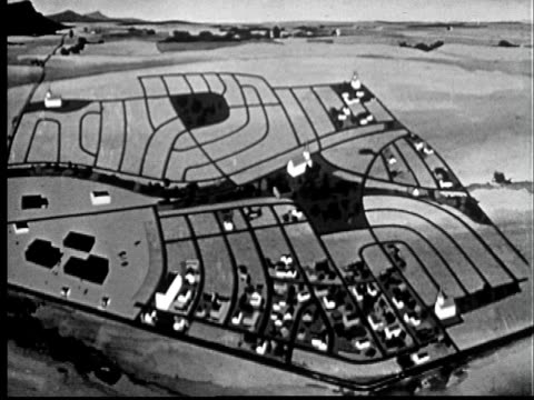
1950s animation map of broomfield heights filling in with houses to demonstrate suburban development/ broomfield, colorado - colorado elevation map stock videos & royalty-free footage00:15"1950s ANIMATION HA WS Map of Broomfield Heights filling in with houses to demonstrate suburban development/ Broomfield, Colorado"
zoom in to denver, colorado, united states from earth. satellite view of the usa. cinematic world map animation from outer space to territories. the concept of highlight the cities, globe, tourism, travel, aerial view of country - colorado elevation map stock videos & royalty-free footage00:16Zoom in to Denver, Colorado, United States from Earth. Satellite view of the USA. Cinematic world map animation from outer space to territories. The concept of highlight the cities, globe, tourism, travel, aerial view of country
zoom in to colorado springs, colorado, united states from earth. satellite view of the usa. cinematic world map animation from outer space to territories. the concept of highlight the cities, globe, tourism, travel, aerial view of country - colorado elevation map stock videos & royalty-free footage00:16Zoom in to Colorado Springs, Colorado, United States from Earth. Satellite view of the USA. Cinematic world map animation from outer space to territories. The concept of highlight the cities, globe, tourism, travel, aerial view of country
zoom in to colorado springs, colorado, united states from earth. satellite view of the usa. cinematic world map animation from outer space to territories. the concept of highlight the cities, globe, tourism, travel, aerial view of country - colorado elevation map stock videos & royalty-free footage00:16Zoom in to Colorado Springs, Colorado, United States from Earth. Satellite view of the USA. Cinematic world map animation from outer space to territories. The concept of highlight the cities, globe, tourism, travel, aerial view of country
zoom in to aspen, colorado, united states from earth. satellite view of the usa. cinematic world map animation from outer space to territories. the concept of highlight the cities, globe, tourism, travel, aerial view of country - colorado elevation map stock videos & royalty-free footage00:16Zoom in to Aspen, Colorado, United States from Earth. Satellite view of the USA. Cinematic world map animation from outer space to territories. The concept of highlight the cities, globe, tourism, travel, aerial view of country
zoom in to aspen, colorado, united states from earth. satellite view of the usa. cinematic world map animation from outer space to territories. the concept of highlight the cities, globe, tourism, travel, aerial view of country - colorado elevation map stock videos & royalty-free footage00:16Zoom in to Aspen, Colorado, United States from Earth. Satellite view of the USA. Cinematic world map animation from outer space to territories. The concept of highlight the cities, globe, tourism, travel, aerial view of country
aerial perspective showcasing twin pipelines navigating snowy terrain amid forested environment for planning - colorado elevation map stock videos & royalty-free footage00:22Aerial perspective showcasing twin pipelines navigating snowy terrain amid forested environment for planning
quiet forest residence, remote rural residence embedded amid tall pine trees close to transit routes - colorado elevation map stock videos & royalty-free footage00:12Quiet forest residence, Remote rural residence embedded amid tall pine trees close to transit routes
//www.denver7.com/weather/weather-news/rare-tornado-touches-down-near-westcliffe-in-custer-county rare high-elevation tornado touched down in... - colorado elevation map stock videos & royalty-free footage00:30Rare Tornado Rips Through Colorado Mountain TownTornado
"begin boulder dam! las vegas, nev. - site of gigantic power project, named for president hoover, is visited by sec'y of interior wilbur" / crowd... - colorado elevation map stock videos & royalty-free footage01:33Dedication of site of construction of Hoover Dam in NevadaHoover Dam, Construction Site, Archival
zoom in to colorado, us from earth. satellite view of the united states of america. cinematic world map animation from outer space to territories. the concept of highlight the state, globe, tourism, travel, journey, aerial view of country, usa - colorado elevation map stock videos & royalty-free footage00:16Zoom in to Colorado, US from Earth. Satellite view of the United States of America. Cinematic world map animation from outer space to territories. The concept of highlight the state, globe, tourism, travel, journey, aerial view of country, USA
colorada flag and map of colorada zoomed to earth from space, real-time photo-animation. - colorado elevation map stock videos & royalty-free footage00:21Colorada flag and map of Colorada zoomed to earth from space, real-time photo-animation.
"colorado - air academy shown in models" superimposed over scale model of air academy / aerial colorado springs, panning over to rocky mountain range... - colorado elevation map stock videos & royalty-free footage00:44Air Force Secretary Harold E. Talbott unveils the model for Air Force Academy
"big flood plan announced - president views stricken areas" / pres. dwight eisenhower at night walking towards air force one at lowry air force base... - colorado elevation map stock videos & royalty-free footage00:53President Dwight Eisenhower surveys by plane flood-stricken areas in Northeast region of US and then meets with governors in Hartford, CT
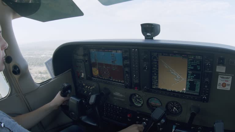
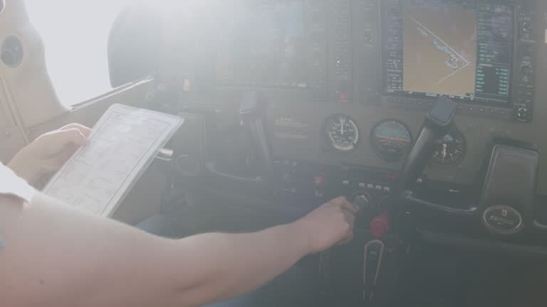
young adult female pilot flying a single engine plane and climbing at the best rate of climb and adjusting the multi-function flight display to the map page - colorado elevation map stock videos & royalty-free footage00:11Young Adult Female Pilot Flying a Single Engine Plane and Climbing at the Best Rate of Climb and Adjusting the Multi-Function Flight Display to the Map PageGlobal Positioning System, Aeroplane, Propeller Aeroplane
young adult female pilot reducing the throttle to idle and preparing for a short field takeoff - colorado elevation map stock videos & royalty-free footage00:10Young Adult Female Pilot Reducing the Throttle to Idle and Preparing for A Short Field Takeoff
low angle governor john fine, pennsylvania; governor daniel thornton, colorado; and governor allan shivers, texas stand in military receiving line... - colorado elevation map stock videos & royalty-free footage02:02Governors John Fine, Daniel Thornton, and Allan Shivers visit South Korea front line and orphanage in 1954
a solar farm just off the highway in the high desert of western colorado and the eastern utah border, the la sal mountains in the background - colorado elevation map stock videos & royalty-free footage00:05A Solar Farm Just Off The Highway In The High Desert Of Western Colorado And The Eastern Utah Border, The La Sal Mountains In The background
a solar farm just off the highway in the high desert of western colorado and the eastern utah border, with a dusting off snow between the panels - colorado elevation map stock videos & royalty-free footage00:08A Solar Farm Just Off The Highway In The High Desert Of Western Colorado And The Eastern Utah Border, With A Dusting Off Snow Between The Panels
a solar farm just off the highway in the high desert of western colorado and the eastern utah border - colorado elevation map stock videos & royalty-free footage00:13A Solar Farm Just Off The Highway In The High Desert Of Western Colorado And The Eastern Utah Border
a solar farm just off the highway in the high desert of western colorado and the eastern utah border, the la sal mountains in the background - colorado elevation map stock videos & royalty-free footage00:06A Solar Farm Just Off The Highway In The High Desert Of Western Colorado And The Eastern Utah Border, The La Sal Mountains In The background
a solar farm just off the highway in the high desert of western colorado and the eastern utah border, the la sal mountains in the background - colorado elevation map stock videos & royalty-free footage00:12A Solar Farm Just Off The Highway In The High Desert Of Western Colorado And The Eastern Utah Border, The La Sal Mountains In The background
a solar farm just off the highway in the high desert of western colorado and the eastern utah border, with a dusting off snow between the panels - colorado elevation map stock videos & royalty-free footage00:10A Solar Farm Just Off The Highway In The High Desert Of Western Colorado And The Eastern Utah Border, With A Dusting Off Snow Between The Panels
a solar farm just off the highway in the high desert of western colorado and the eastern utah border, with book cliff mountains behind - colorado elevation map stock videos & royalty-free footage00:10A Solar Farm Just Off The Highway In The High Desert Of Western Colorado And The Eastern Utah Border, With Book Cliff Mountains Behind
statue of alexander hamilton outside the treasury department in washington dc / ext federal hall on wall street with statue of george washington in... - colorado elevation map stock videos & royalty-free footage01:20US plans to move gold to Denver and Fort Knox with VS US Treasury, Sub Treasury, US Mint, aerials of Fort KnoxFort Knox, Kentucky, Ingot