world map farming and agriculture green icon pattern - plot map stock illustrationsWorld Map Farming and Agriculture Green Icon PatternPattern
Founder of the International Flat Earth Research Society , Samuel Shenton , 15th August 1967.Samuel ShentonGlobe - Navigational Equipment, Map
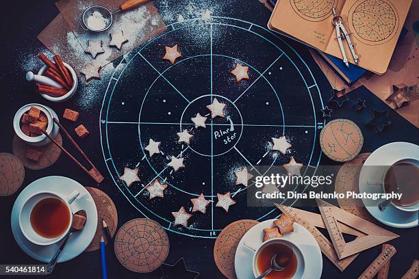
teatime under the polar star - plot map stock pictures, royalty-free photos & imagesTeatime under the Polar starAstrology, Star Shape, No People
line graph environmental conservation and nature interface icon pattern - plot map stock illustrationsLine Graph Environmental Conservation and Nature interface icon Pattern
green tree environmental conservation and nature vector interface icon pattern - plot map stock illustrationsGreen Tree Environmental Conservation and Nature Vector interface icon Pattern
a map of india sheet viii, calcutta kolkata, west bengal, india - plot map stock pictures, royalty-free photos & imagesA map of India sheet VIII, Calcutta Kolkata, West Bengal, India
a map of india for diffusion of useful knowledge - plot map stock pictures, royalty-free photos & imagesA map of India for diffusion of useful knowledge
india map, carte du district de tranquebar caart des regtsgebieds van trankanbar - plot map stock pictures, royalty-free photos & imagesIndia map, Carte du district de Tranquebar Caart des Regtsgebieds van Trankanbar
india map, plan of the city of cochin, kochi, kerala, india - plot map stock pictures, royalty-free photos & imagesIndia map, Plan of the city of Cochin, Kochi, Kerala, India
india map, the british possession in the east india, with the dependent states and countries adjacent - plot map stock pictures, royalty-free photos & imagesIndia map, the british possession in the East India, with the dependent states and countries adjacent
a map of india for the diffusion of useful knowledge - plot map stock pictures, royalty-free photos & imagesA map of India for the diffusion of useful knowledge
india map, palais et jardins de cha sousa prince de ragi mohol plan de la ville de mongher - plot map stock pictures, royalty-free photos & imagesIndia map, Palais et Jardins De Cha Sousa Prince de Ragi Mohol Plan De La Ville De Mongher
india map, dabul, dabhal, maharashtra, india - plot map stock pictures, royalty-free photos & imagesIndia map, Dabul, Dabhal, Maharashtra, India
bombay map, grose's plan of bombay 1750, mumbai, maharashtra, india - plot map stock pictures, royalty-free photos & imagesBombay Map, Grose's plan of Bombay 1750, Mumbai, Maharashtra, India
india map, waltham savery - plot map stock pictures, royalty-free photos & imagesIndia map, waltham savery
india map, plan de la ville de cochin, kochi, kerala, india - plot map stock pictures, royalty-free photos & imagesIndia map, plan de la ville de cochin, Kochi, Kerala, India
military and munity mutiny views map plan of sir hugh wheeler's position of chwnpore, kanpur, uttar pradesh, india - plot map stock pictures, royalty-free photos & imagesMilitary and munity mutiny views map plan of Sir Hugh Wheeler's position of Chwnpore, Kanpur, Uttar Pradesh, IndiaPlanning
military and munity mutiny views map city of lucknow, uttar pradesh, india - plot map stock pictures, royalty-free photos & imagesMilitary and munity mutiny views Map City of Lucknow, Uttar Pradesh, India
military and munity mutiny views plan of the attack on delhi map, india - plot map stock pictures, royalty-free photos & imagesMilitary and munity mutiny views plan of the attack on Delhi map, India
map of hindustan, hindustan, india - plot map stock pictures, royalty-free photos & imagesMap of Hindustan, Hindustan, India
india map, a plan of the fonn fortress of garlah belonging to angrla the admiral to the pahou rajah on the coast of mallabar - plot map stock pictures, royalty-free photos & imagesIndia map, a plan of the fonn fortress of garlah belonging to angrla the admiral to the pahou rajah on the coast of mallabar
india map, a correct chart of the coasts of hindostan engraved for malham's naval gazetteer - plot map stock pictures, royalty-free photos & imagesIndia map, a correct chart of the coasts of HINDOSTAN engraved for Malham's Naval Gazetteer
a map of india iii, bombay now mumbai, maharashtra, india - plot map stock pictures, royalty-free photos & imagesA map of India III, Bombay now Mumbai, Maharashtra, India
india map, city of diu, gujarat, india - plot map stock pictures, royalty-free photos & imagesIndia map, City of Diu, Gujarat, India
a map of india showing the route of h.r.h. the prince of wales 1875 - plot map stock pictures, royalty-free photos & imagesA map of India showing the route of H.R.H. the prince of Wales 1875
india map, cananoor, kannur, malabar coast, kerala, india - plot map stock pictures, royalty-free photos & imagesIndia map, Cananoor, kannur, Malabar coast, Kerala, India
a map of india ii, madras now chennai, tamil nadu, india - plot map stock pictures, royalty-free photos & imagesA map of India II, Madras now Chennai, Tamil Nadu, India
a map of india for the diffusion of useful knowledge - plot map stock pictures, royalty-free photos & imagesA map of India for the diffusion of useful knowledge
a map of india showing kingdoms, states, river, cities, towns and forts etc - plot map stock pictures, royalty-free photos & imagesA map of India showing kingdoms, states, river, cities, towns and forts etc
india map, carte de la partie inferieure de linde en deca du gange - plot map stock pictures, royalty-free photos & imagesIndia map, carte de la partie inferieure de linde en deca du gange
india map, carte de la partie superieure - plot map stock pictures, royalty-free photos & imagesIndia map, carte de la partie superieure
bombay maps, map of hindustan, hindustan, india - plot map stock pictures, royalty-free photos & imagesBombay maps, map of Hindustan, Hindustan, IndiaArt
a map of india and ceylon - plot map stock pictures, royalty-free photos & imagesA map of India and Ceylon
india map, suite de la carte de l inde en deca du gange - plot map stock pictures, royalty-free photos & imagesIndia map, suite de la carte de l inde en deca du gange
india map, partie de la terre ferme de linde ou l emprie du mogol - plot map stock pictures, royalty-free photos & imagesIndia map, partie de la terre ferme de linde ou l emprie du mogol
india map, cartedes costes de concan et decan - plot map stock pictures, royalty-free photos & imagesIndia map, cartedes costes de concan et decan
india map, inde ancienne a l'occident de gange - plot map stock pictures, royalty-free photos & imagesIndia map, inde ancienne a l'occident de gange
india map, map of calcutta kolkata showing public buildings and churches etc, india - plot map stock pictures, royalty-free photos & imagesIndia map, map of Calcutta Kolkata showing public buildings and churches etc, India
bombay map, plan de bombay, mumbai, maharashtra, india - plot map stock pictures, royalty-free photos & imagesBombay map, Plan de Bombay, Mumbai, Maharashtra, India
bombay map, niebuhr's map 1764, mumbai, maharashtra, india - plot map stock pictures, royalty-free photos & imagesBombay map, Niebuhr's map 1764, Mumbai, Maharashtra, IndiaMumbai
bombay map, mapla por, the first court house, mumbai, maharashtra, india - plot map stock pictures, royalty-free photos & imagesBombay map, Mapla Por, the first court house, Mumbai, Maharashtra, IndiaPlanning
bombay map, map of the port and island of bombay with the adjacent islands, 1724, mumbai, maharashtra, india - plot map stock pictures, royalty-free photos & imagesBombay Map, map of the Port and Island of Bombay with the adjacent Islands, 1724, Mumbai, Maharashtra, India
bombay map, map of the island of bombay, reproduced from plan in 1843, mumbai, maharashtra, india - plot map stock pictures, royalty-free photos & imagesBombay Map, map of the island of Bombay, reproduced from plan in 1843, Mumbai, Maharashtra, India
bombay map, map of the island of bombay and colaba, 1843, mumbai, maharashtra, india - plot map stock pictures, royalty-free photos & imagesBombay Map, map of the island of Bombay and Colaba, 1843, Mumbai, Maharashtra, India
bombay map, island of bombay by capt. thomas dickson, year 1812 16, mumbai, maharashtra, india - plot map stock pictures, royalty-free photos & imagesBombay Map, island of Bombay by Capt. Thomas Dickson, year 1812 16, Mumbai, Maharashtra, India
bombay map, fryer's map of bombay 1672, mumbai, maharashtra, india - plot map stock pictures, royalty-free photos & imagesBombay Map, Fryer's map of Bombay 1672, Mumbai, Maharashtra, India
bombay map, environs of bombay, mumbai, maharashtra, india - plot map stock pictures, royalty-free photos & imagesBombay Map, environs of Bombay, Mumbai, Maharashtra, India
bombay map, french plan of bombay island 1767, mumbai, maharashtra, india - plot map stock pictures, royalty-free photos & imagesBombay Map, French plan of Bombay island 1767, Mumbai, Maharashtra, India
bombay map, city of bombay, mumbai, maharashtra, india - plot map stock pictures, royalty-free photos & imagesBombay Map, city of Bombay, Mumbai, Maharashtra, IndiaMumbai
bombay map, french plan of bombay fort 1758, mumbai, maharashtra, india - plot map stock pictures, royalty-free photos & imagesBombay Map, French plan of Bombay fort 1758, Mumbai, Maharashtra, India
bombay map, bombay fort 1771, 1864, mumbai, maharashtra, india - plot map stock pictures, royalty-free photos & imagesBombay map, Bombay fort 1771, 1864, Mumbai, Maharashtra, India
Plan March Strategy. New York, New York: African-American integration leaders plot route of projected August 28, "March on Washington," on a map in a...Integration Leaders Planning March
Harold Graham ; Bernard Simmonds plot moves on map.Harold Graham (left); Bernard Simmonds plot moves on map.
Signal Corps officers plot movements on a map, New Caledonia, World War II.US Signal Corps In New CaledoniaWorld War II, New Caledonia