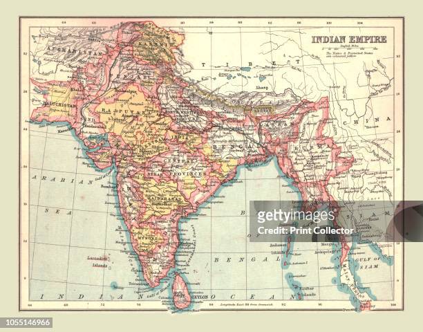
Map of the Indian Empire, 1902. Showing the Indian subcontinent during the period of the British Raj . From The Century Atlas of the World. [John...
Placide de Sainte-Helene cartographer and Augustine monk was the brother-in-law of Pierre Duval , geographer to the King of France, Louis XIV.
map of myanmar with a myanmarese, burmese, flag with a grunge texture - myanmar map stock pictures, royalty-free photos & images
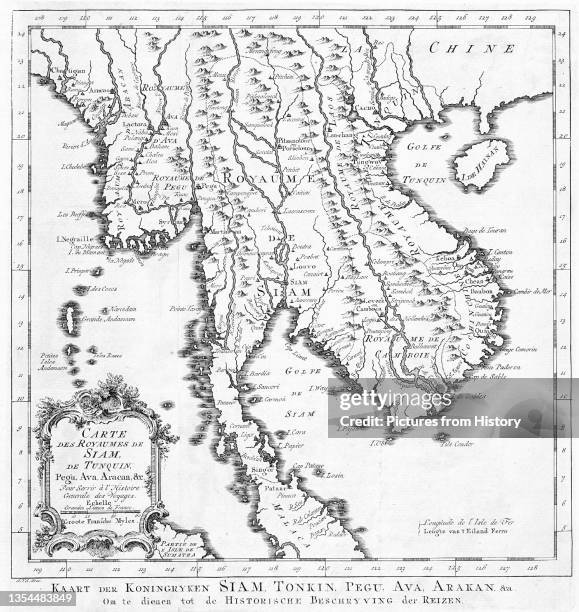
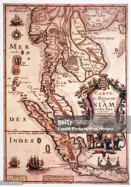
Map of Burma, Thailand, Cambodia, Laos and Vietnam, engraving after a drawing by Pitteri, from Atlante Novissimo , Volume IV, published by Antonio...
myanmar passport stamp - international border visa ink stamp for entry into the country - myanmar map stock pictures, royalty-free photos & images
Herman Moll , was a cartographer, engraver, and publisher. Moll produced his earliest maps from studying cartographers such as John Senex and Emanuel...
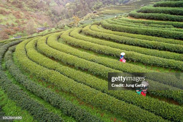
aerail view tea farm with sea of mist, green tree, blue mountain and sunlight beam in the morning at doi ang khang, chiangmai, thailand. - myanmar map stock pictures, royalty-free photos & images
The World at the Beginning of the 20th Century Showing British Possessions' [in pink], circa 1900. From "Cassell's History of England, Vol. IX"....
This photograph taken on September 22, 2019 shows Myanmar information technology volunteers assisting mobile phone users switching from the old...
football or soccer ball with shan state flag icon for championship - myanmar map stock pictures, royalty-free photos & images
Jakob van der Schley aka Jakob van Schley was a Dutch draughtsman and engraver. He studied under Bernard Picart whose style he subsequently copied....
football or soccer ball with myanmar flag icon for championship - myanmar map stock pictures, royalty-free photos & images
Gerardus Mercator, a Flemish German was a cartographer renowned for creating a world map based on a new projection which represented sailing courses...
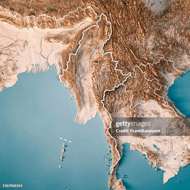
myanmar 3d render topographic map neutral border - myanmar map stock pictures, royalty-free photos & images
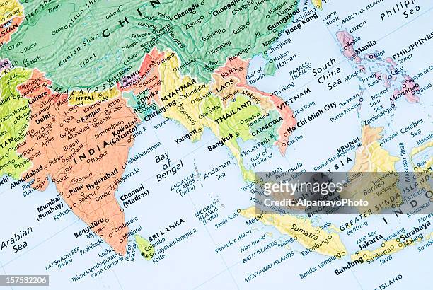
Map Of Eastern India , Map Showing Historical Boundaries Of Eastern India, Burma, Siam And French Indo-China, Circa 1902, From The 10Th Edition Of...
aerail view tea farm with sea of mist, green tree, blue mountain and sunlight beam in the morning at doi ang khang, chiangmai, thailand. - myanmar map stock pictures, royalty-free photos & images
International Committee of the Red Cross President Jakob Kellenberger points the ICRC office in Taunggyi on a map of Myanmar during a news conference...
myanmar 3d render topographic map color border - myanmar map stock pictures, royalty-free photos & images
This picture taken on February 21, 2017 shows Nonnon, a 47-year-old Myanmar refugee and nail artist, holding a map of Myanmar at a nail salon in...
Satellite view of Myanmar . This image was compiled from data acquired by LANDSAT 5 & 7 satellites., Myanmar , Asia, True Colour Satellite Image With...
An infographic titled "Myanmar military attack on a refugee camp" created in Ankara, Turkiye on October 10, 2023. An artillery strike hit a refugee...
Major General Thomas Wynford Rees of the British Indian Army, 19th Indian Infantry Division, posed standing in front of a map of Burma after...
Soldiers from the Karenni Nationalities Defence Force prepare on a map a military operation against the Burmese army in Southern Shan State. The...
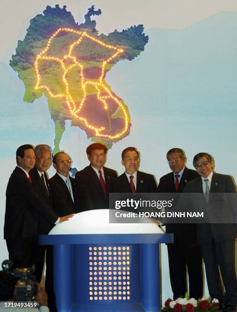
Prime Ministers Nguyen Tan Dung from Vietnam, Samak Sundaravej from Thailand, Thein Sein from Myanmar, Buasone Bouphavanh from Laos, Premier Wen...
Indonesia, the region's largest economy, makes the top five in this map exploring Southeast Asia's GDP per capita levels. Data source: International...
Maui , commander in chief of the Karenni Nationalities Defence Force , checks a map while inspecting the Loikaw university that was seized during an...
An old map of the Shan State. "Khun Sa Old Camp", the former northern Thailand base of ethnic Chinese drug lord and warlord "Khun Sa". Khun Sa was...
Painting of the former "Keng Tung Palace" under "Mong Tai Lords Territory" and a map of the Shan State . "Khun Sa Old Camp", the former northern...
Woman police officer shows a map illustrating the route of drug trafficking originating from neighbours Myanmar and Laos, at the Public Security...
Saigon Map - Map printed in Burma in 1946 by the Aerial Reconnaissance Detachment of the British Army Burma Command. This map was drawn based on the...
David Eubank , founder and director of the Free Burma Rangers , surrounded by Rangers and soldiers from armed ethnic groups, consults a map during a...
David Eubank , founder and director of the Free Burma Rangers , and Albert , the commander of a battalion of the Karenni Nationalities Defence Force...
The operations of Force Viper, Burma, World War II, 1942-1943 . From "The Royal Marines - The Admiralty Account of Their Achievement 1939-43". [His...
Major General Thomas Wynford Rees of the British Indian Army, 19th Indian Infantry Division, seated with a map in the front seat of a vehicle ahead...
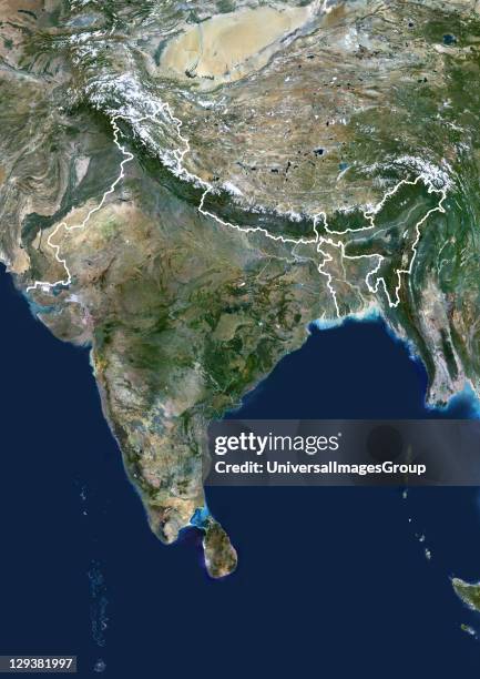
India, true colour satellite image with border. This image shows the Indian subcontinent, bordered by Pakistan to the northwest and China and Nepal...
This photograph taken on September 22, 2019 shows Myanmar information technology volunteers assisting a mobile phone user switching from the old...


![The World at the Beginning of the 20th Century Showing British Possessions' [in pink], circa 1900. From "Cassell's History of England, Vol. IX"....](https://media.gettyimages.com/id/1511734190/photo/the-world-at-the-beginning-of-the-20th-century-showing-british-possessions-in-pink-circa.jpg?s=612x612&w=gi&k=20&c=2oAJri8r_aQz5g_w7ovMJaVZ-27gmiJHwBdUSVB420U=)