the british empire from 1883 - british empire map stock illustrationsThe British Empire From 1883British Empire, Map, World Map
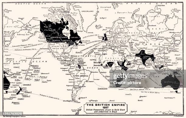
the british empire 1897 (high resolution with great detail) - british empire map stock illustrationsTHE BRITISH EMPIRE 1897 (High resolution with great detail)British Empire, Map, World Map
antique commercial map of the world - british empire map stock illustrationsAntique Commercial Map of the WorldMap, British Empire, World Map
the british empire 1837 (high resolution with great detail) - british empire map stock illustrationsTHE BRITISH EMPIRE 1837 (High resolution with great detail)Map, British Empire, World Map
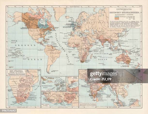
development of the british empire, lithograph, published 1897 - british empire map stock illustrationsDevelopment of the British Empire, lithograph, published 1897Map, World Map, 17th Century
map from old french atlas: british colonies - british empire map stock illustrationsMap from old French Atlas: British ColoniesMap, British Empire, UK
map of the british empire in 1897 - british empire map stock illustrationsMap of the British Empire in 1897Map, World Map, British Empire
antique map of india - british empire map stock illustrationsAntique map of IndiaIndia, Map, British Empire
the victorian world - british empire map stock illustrationsThe Victorian WorldGlobe - Navigational Equipment, Cartoon, World Map
map of the massachusetts bay colony in 1676, lithograph, 1876 - british empire map stock illustrationsMap of the Massachusetts Bay Colony in 1676, lithograph, 1876Map, USA, Coastline
map of the cape, south africa, in the 17th century - british empire map stock illustrationsMap of the Cape, South Africa, in the 17th centuryMap, Africa, Cape Town
engraved antique, great britain and ireland engraving antique illustration, published 1851 - british empire map stock illustrationsEngraved Antique, Great Britain and Ireland Engraving Antique Illustration, Published 1851Scotland, Map, Engraved Image
historical map of east india, lithograph, published in 1897 - british empire map stock illustrationsHistorical map of East India, lithograph, published in 1897Map, India, Bihar
antique map of india, 1880s, 19th century - british empire map stock illustrationsAntique map of India, 1880s, 19th CenturyIndia, Map, Old-fashioned
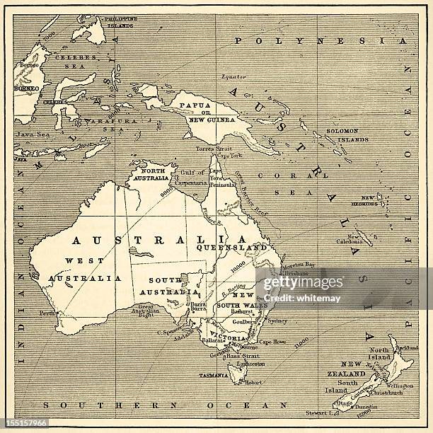
map of australasia (1882 engraving) - british empire map stock illustrationsMap of Australasia (1882 engraving)Map, Australia
map of the residency, lucknow during the indian rebellion, or sepoy mutiny of 1857, victorian military history - british empire map stock illustrationsMap of The Residency, Lucknow during the Indian Rebellion, or Sepoy Mutiny of 1857, Victorian military historyMap, Plan - Document, India
mid-victorian map of india - british empire map stock illustrationsMid-Victorian map of IndiaMap, India
old antique map of indian empire, british raj, with cross section north to south, 1890s, 19th century - british empire map stock illustrationsOld Antique map of Indian Empire, British Raj, with cross section north to south, 1890s, 19th CenturyIndia, Map, British Empire
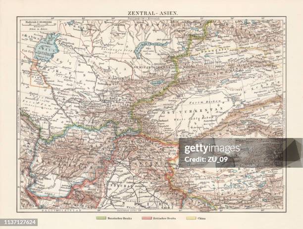
historical topographic map of central asia, lithograph, published in 1897 - british empire map stock illustrationsHistorical topographic map of Central Asia, lithograph, published in 1897Map, Punjab - Pakistan, Uzbekistan
1882 map of africa with distances from london - british empire map stock illustrations1882 map of Africa with distances from LondonAfrica, Map, Engraved Image
map of australia and over asia. - british empire map stock illustrationsMap of Australia and over Asia.
historical city map of singapore and singapore strait, published 1897 - british empire map stock illustrationsHistorical city map of Singapore and Singapore Strait, published 1897Map
united kingdom map dark green - british empire map stock illustrationsUnited Kingdom map dark greenUK, Map, Striped
map from old french atlas: india, economy - british empire map stock illustrationsMap from old French Atlas: India, EconomyMap, India
germany sketched map on grid - british empire map stock illustrationsGermany sketched map on gridGermany, Sketch
map of asia 19th century - british empire map stock illustrationsMap of Asia 19th centuryMap, British Empire
map of australasia (1898 engraving) - british empire map stock illustrationsMap of Australasia (1898 engraving)Map, Northern Territory - Australia, Australia
united kingdom orange map on grid background - british empire map stock illustrationsUnited Kingdom orange map on grid backgroundUK, Map
map from old french atlas: east australia - british empire map stock illustrationsMap from old French Atlas: East Australia
map from old french atlas: new zealand - british empire map stock illustrationsMap from old French Atlas: New Zealand
antique map of india or hindustan - british empire map stock illustrationsAntique Map of India or HindustanMap, India, Bangladesh
map of the irrawaddy river, myanmar, wood engraving, published 1899 - british empire map stock illustrationsMap of the Irrawaddy River, Myanmar, wood engraving, published 1899Map
map of canada and new brunswick 1867 - british empire map stock illustrationsMap of Canada and New Brunswick 1867Quebec, Map
map from old french atlas: south africa - british empire map stock illustrationsMap from old French Atlas: South AfricaMap, South Africa
cartoon map of virginia - british empire map stock illustrationsCartoon Map of VirginiaMap, Washington DC, Roanoke - Virginia
plan of the entrenchment at cawnpore - british empire map stock illustrationsPlan of the Entrenchment at CawnporeMap, Military, Asia
map of massachusetts 1894 - british empire map stock illustrationsMap of Massachusetts 1894Map, Massachusetts
map of australia in color and with detail. - british empire map stock illustrationsMap of Australia in color and with detail.Australia, USA, North
map from old french atlas: british colonies in canada and antilles - british empire map stock illustrationsMap from old French Atlas: British Colonies in Canada and Antilles
hong kong sketched map on grid - british empire map stock illustrationsHong Kong sketched map on gridHong Kong, Map
engraving: great britain and ireland - british empire map stock illustrationsEngraving: Great Britain and Ireland
historical map of german east africa, wood engraving, published 1899 - british empire map stock illustrationsHistorical map of German East Africa, wood engraving, published 1899Map
map of australia in black on a transparent background. - british empire map stock illustrationsMap of Australia in black on a transparent background.
historical buildings of india coming out from the zipper of a soccer ball - british empire map stock illustrationsHistorical buildings of India coming out from the zipper of a soccer ball
map of australia in outline, in black and in detail. 3 cards. - british empire map stock illustrationsMap of Australia in outline, in black and in detail. 3 cards.
great britain and ireland engraving antique illustration, published 1851 - british empire map stock illustrationsGreat Britain and Ireland Engraving Antique Illustration, Published 1851