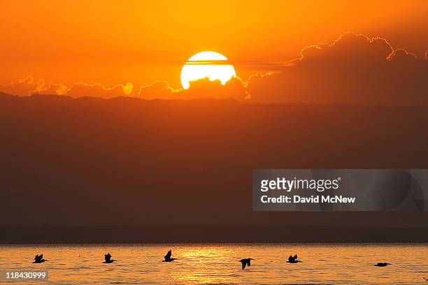
Pelicans fly to Mullet Island, one of the four Salton Buttes, small volcanoes on the southern San Andreas Fault, after sunset on July 2, 2011 near...
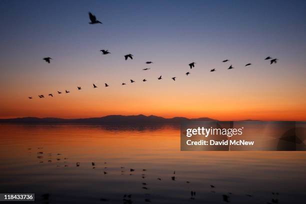
Pelicans fly over the Salton Sea at sunrise on July 7, 2011 in Salton City, California. Scientists have discovered that human-created changes...
Pelicans fly over the Salton Sea at sunrise on July 7, 2011 in Salton City, California. Scientists have discovered that human-created changes...
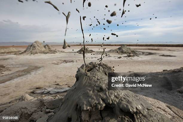
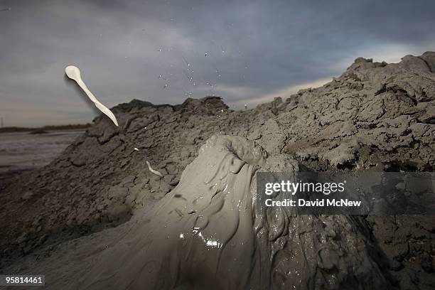
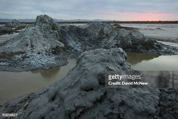
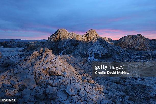
Mud flies as carbon dioxide gas from deep underground fissures escapes through geothermal mudpots, or mud volcanoes, over the southern San Andreas...
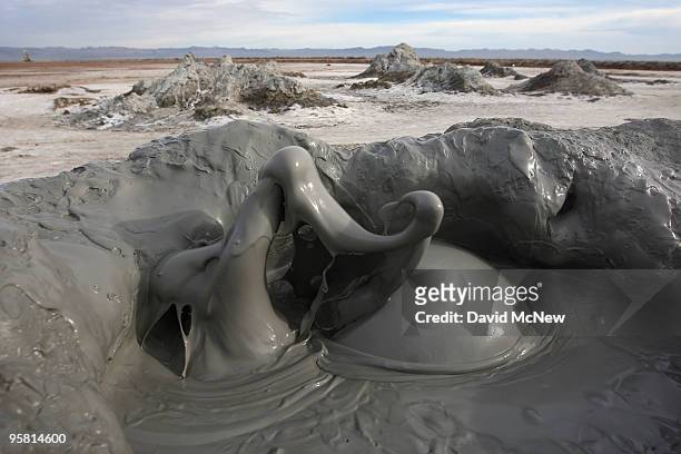
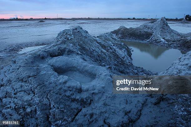
Carbon dioxide gas from deep underground fissures bubbles up through geothermal mudpots, or mud volcanoes, over the southern San Andreas earthquake...
Carbon dioxide gas from deep underground fissures bubbles up through geothermal mudpots, or mud volcanoes, over the southern San Andreas earthquake...
Mud flies as carbon dioxide gas from deep underground fissures escapes through geothermal mudpots, or mud volcanoes, over the southern San Andreas...
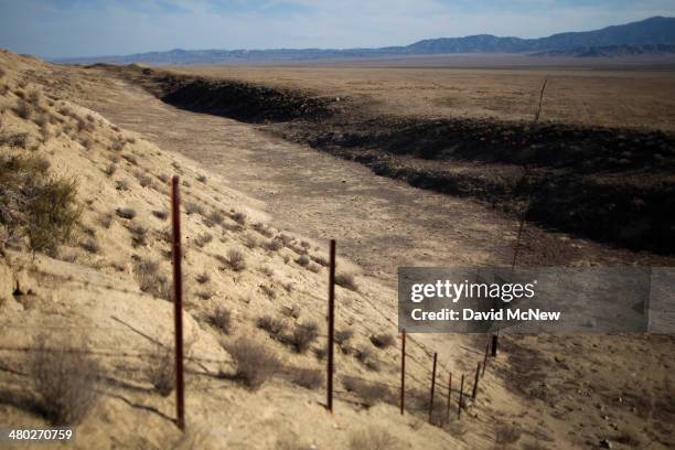
The east branch of the California Aqueduct, which imports water from the Sierra Nevada Mountains, crosses the San Andreas Rift Zone, the system of...
The east branch of the California Aqueduct, which imports water from the Sierra Nevada Mountains, crosses the San Andreas Rift Zone, the system of...
Residents attend a peewee baseball game south of the San Andreas Rift Zone, the system of depressions in the ground between the parallel faults of...
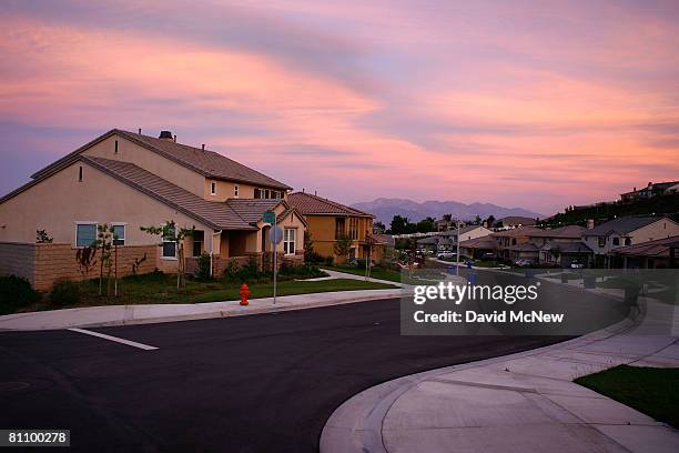
Recently built homes are seen in suburban neighborhoods on top of the San Andreas Rift Zone, the system of depressions in the ground between the...
Freight train passes diagonally-shifted layers of earth as it crosses the San Andreas Rift Zone, the system of depressions in the ground between the...
Recently built homes are seen in suburban neighborhoods on top of the San Andreas Rift Zone, the system of depressions in the ground between the...
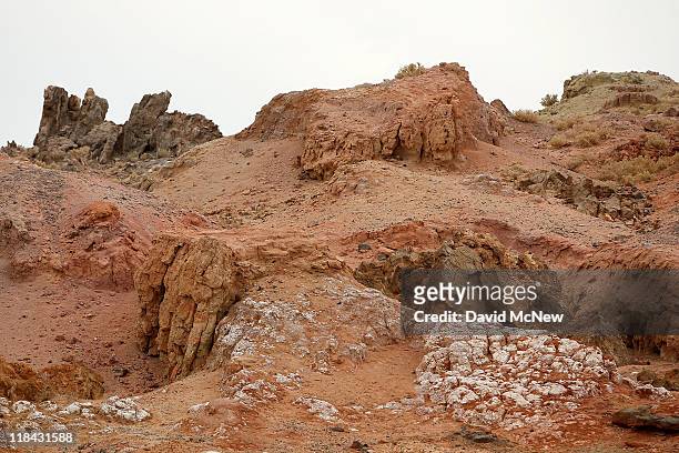
Red Hill, one of the four Salton Buttes, small volcanoes on the southern San Andreas Fault, at the Salton Sea is seen on July 6 near Calipatria,...
Mud boils violently in steam vents that, until recently, were underwater on the floor of the Salton Sea, on June 30 near Calipatria, California....
Red Hill, one of the four Salton Buttes, small volcanoes on the southern San Andreas Fault, at the Salton Sea is seen on July 6 near Calipatria,...
Geothermal energy plant taps deep underground heat from the southern San Andreas Fault rift zone near the Salton Sea on July 6 near Calipatria,...
Pelicans fly around Mullet Island, one of the four Salton Buttes, small volcanoes on the southern San Andreas Fault, to roost for the night on July 3...
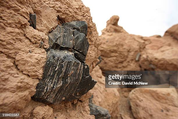
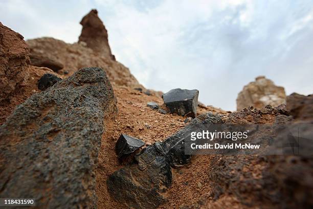
Obsidian, volcanic stone valued by native Americans for millennia for making arrowheads and spear tips and for trading with other tribes, are seen...
Red Hill, one of the four Salton Buttes, small volcanoes on the southern San Andreas Fault, at the Salton Sea is seen on July 6 near Calipatria,...
Rock Hill, one of the four Salton Buttes, small volcanoes on the southern San Andreas Fault, and a geothermal energy plant are seen at the edge of...
The San Andreas Fault rift zone is seen on the west side of Temblor Ridge which divides it from the oil fields of the Monterey Shale formation where...
The San Andreas Fault rift zone is seen on the west side of Temblor Ridge which divides it from the oil fields of the Monterey Shale formation where...
Heavily-quarried, Red Hill, one of the four Salton Buttes, small volcanoes on the southern San Andreas Fault, at the Salton Sea is seen on July 6...
Obsidian, volcanic stone valued by native Americans for millennia for making arrowheads and spear tips and for trading with other tribes, are seen...
Obsidian, volcanic stone valued by native Americans for millennia for making arrowheads and spear tips and for trading with other tribes, are seen...
Obsidian, volcanic stone valued by native Americans for millennia for making arrowheads and spear tips and for trading with other tribes, are seen...
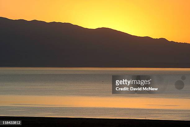
The Salton Sea is seen before sunrise on July 2, 2011 near Salton City, California. Scientists have discovered that human-created changes effecting...
Geothermal energy plant taps deep underground heat from the southern San Andreas Fault rift zone near the Salton Sea on July 5 near Calipatria,...
Foundations of buildings of an early 20th century resort that was used before the rising waters of the Salton Sea turned this hill into Mullet...
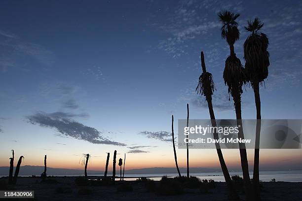
Dead palm trees stand at a former yacht club on the shore of the Salton Sea, the biggest lake in California, which has dried up and refilled numerous...
The Salton Sea is seen before sunrise on July 2, 2011 near Salton City, California. Scientists have discovered that human-created changes effecting...
Geothermal energy plant taps deep underground heat from the southern San Andreas Fault rift zone near the Salton Sea on July 6 near Calipatria,...
Workers drill near a geothermal energy plant to tap deep underground heat from the southern San Andreas Fault rift zone near the Salton Sea on July 6...
Dead tilapia fish lie on dry ground near pilings that once supported a dock at a former yacht club on the shore of the Salton Sea, the biggest lake...
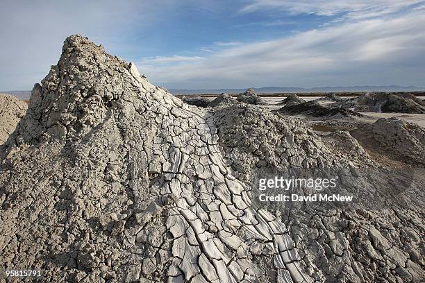
Small mud volcanoes grow above the southern San Andreas Fault near the Salton Sea on June 30 near Calipatria, California. Scientists have discovered...
Geothermal energy plant taps deep underground heat from the southern San Andreas Fault rift zone near the Salton Sea on July 6 near Calipatria,...
Dead palm trees stand at a former yacht club on the shore of the Salton Sea, the biggest lake in California, which has dried up and refilled numerous...
Mud flies as carbon dioxide gas from deep underground fissures escapes through geothermal mudpots, or mud volcanoes, over the southern San Andreas...
Carbon dioxide gas from deep underground fissures bubbles up through geothermal mudpots, or mud volcanoes, over the southern San Andreas earthquake...
Mud flies as carbon dioxide gas from deep underground fissures escapes through geothermal mudpots, or mud volcanoes, over the southern San Andreas...
Carbon dioxide gas from deep underground fissures bubbles up through geothermal mudpots, or mud volcanoes, over the southern San Andreas earthquake...
Carbon dioxide gas from deep underground fissures bubbles up through geothermal mudpots, or mud volcanoes, over the southern San Andreas earthquake...
Geothermal energy plant along the southern San Andreas Fault is reflected in the waters of an irrigated field on January 15, 2010 near Calipatria,...
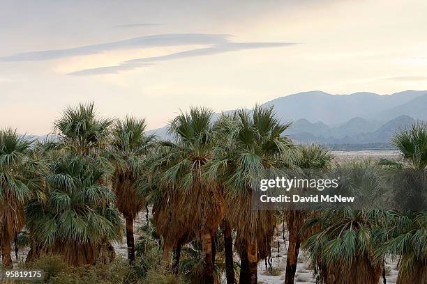
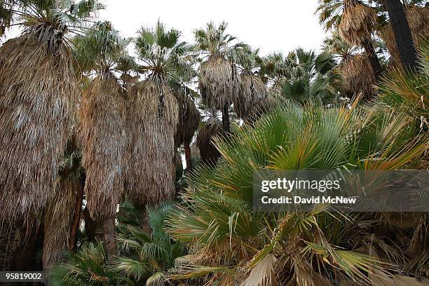
Groves of native palm trees dot the southern San Andreas earthquake fault which forces water to the surface, forming a string of desert oases in...
Carbon dioxide gas from deep underground fissures bubbles up through geothermal mudpots, or mud volcanoes, over the southern San Andreas earthquake...
Groves of native palm trees dot the southern San Andreas earthquake fault which forces water to the surface, forming a string of desert oases in...
Carbon dioxide gas from deep underground fissures bubbles up through geothermal mudpots, or mud volcanoes, over the southern San Andreas earthquake...
Groves of native palm trees dot the southern San Andreas earthquake fault which forces water to the surface, forming a string of desert oases in...
Groves of native palm trees dot the southern San Andreas earthquake fault which forces water to the surface, forming a string of desert oases in...
Snow geese wintering at the Salton Sea National Wildlife Refuge fly near a geothermal energy plant along the southern San Andreas Fault on January...
Groves of native palm trees dot the southern San Andreas earthquake fault which forces water to the surface, forming a string of desert oases in...
Snow geese wintering at the Salton Sea National Wildlife Refuge gather near a geothermal energy plant along the southern San Andreas Fault on January...
Groves of native palm trees dot the southern San Andreas earthquake fault which forces water to the surface, forming a string of desert oases in...
Carbon dioxide gas from deep underground fissures bubbles up through geothermal mudpots, or mud volcanoes, over the southern San Andreas earthquake...
Carbon dioxide gas from deep underground fissures bubbles up through geothermal mudpots, or mud volcanoes, over the southern San Andreas earthquake...
Groves of native palm trees dot the southern San Andreas earthquake fault which forces water to the surface, forming a string of desert oases in...
Light from a geothermal energy plant along the southern San Andreas Fault illuminates dead trees flooded by the rising waters from the Salton Sea on...
Geothermal energy plant draws energy from 680-degrees-Fahrenheit geothermal brines 4,500- to 7,500-feet below ground along the southern San Andreas...
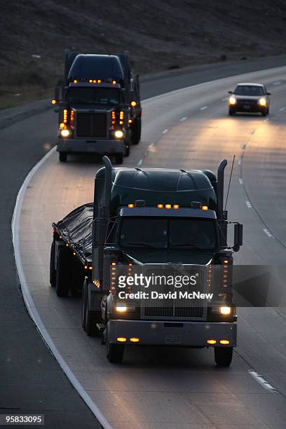
Trucks travel the Interstate 10 freeway on January 17, 2010 near of Indio, California. The San Andreas earthquake fault crosses all roadways and...